What if cities could finally see themselves clearly?
Not through dusty files, outdated maps, or error-prone manual registers—but through precise, real-time aerial intelligence.
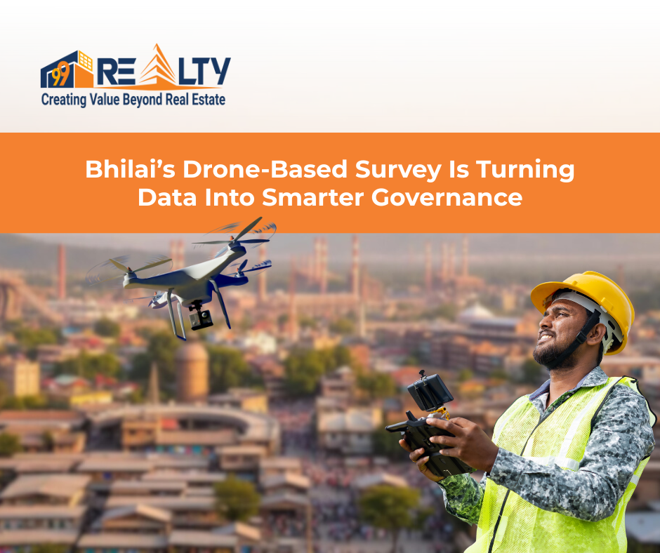
That’s exactly what Bhilai is attempting by teaming up with IIT Bhilai for a drone-based property survey. This initiative isn’t just about flying drones over rooftops; it’s about reshaping how cities govern land, collect taxes, and enable real estate growth. Think of it as switching from blurry eyesight to sharp 4K vision.
Understanding the Bhilai–IIT Bhilai Drone Survey Initiative
The collaboration between the Bhilai Municipal Corporation (BMC) and IIT Bhilai marks a critical shift in how civic bodies approach property management. The goal is simple yet powerful: replace fragmented, outdated property records with a single, accurate, digital source of truth.
By using drones to map residential, commercial, and vacant land parcels, the city aims to modernise its property tax system, improve urban planning, and bring transparency into governance.
How to Apply for Holding Tax in Ranchi: A Complete Guide
Why Bhilai Took the Drone Route
Like many Indian cities, Bhilai faces challenges that are structural, not accidental:
- Inaccurate or outdated property records
- Unauthorised constructions and encroachments
- Property tax leakages
- Long, labour-intensive survey cycles
Traditional methods struggle to keep up with rapid urban growth. Drones, on the other hand, offer a way out—fast, accurate, scalable, and future-ready.
Role of IIT Bhilai in Civic Innovation
This partnership isn’t just administrative; it’s technical at its core.
IIT Bhilai brings:
- Advanced photogrammetry techniques
- GIS mapping expertise
- Robust data validation and accuracy models
This ensures the survey is not just high-tech, but high-credibility—something both citizens and developers can trust.
What Is a Drone-Based Property Survey?
At its core, a drone-based property survey uses unmanned aerial vehicles equipped with high-resolution cameras and GPS systems to map land and built structures from above. These drones also capture elevation and contour data, helping authorities and developers understand site conditions, density patterns, and land usage with precision.
How Drone Mapping Works
Data Collection and Imaging
Drones fly along predefined routes, capturing thousands of overlapping images that cover every plot, roof, road, and boundary—ensuring no parcel is overlooked.
GIS Integration and Digital Records
These images are stitched into orthomosaic maps and layered into GIS systems, creating digital property records that are:
- Measurable
- Searchable
- Verifiable
This data becomes the backbone of accurate property valuation, smarter planning approvals, and long-term real estate decision-making.
Why Traditional Property Surveys Are No Longer Enough
Let’s be honest—manual surveys are tired.
Time Delays and Human Error
They take months, involve multiple departments, and are vulnerable to inconsistencies.
Revenue Leakages and Disputes
Missed properties, incorrect measurements, and outdated data lead directly to revenue loss and endless disputes.
Drones fix both.
Key Benefits for Government Authorities
This is where the real transformation begins.
Accurate Property Tax Assessment
With exact built-up areas and verified land usage, taxation becomes fair and data-driven, not arbitrary.
Identification of Unauthorised Constructions
Illegal extensions, encroachments, and misuse of land become visible instantly—without door-to-door inspections.
Creation of a Single Source of Truth
One digital map. One database. Zero ambiguity.
Support for Smart City Planning
Road widening, drainage systems, utility planning, disaster preparedness—everything improves when the data is accurate.
How Drone Surveys Strengthen Urban Governance
Transparency and Public Trust
When citizens know taxes are based on facts rather than estimates, trust in local governance improves.
Faster Policy Execution
Zoning changes, redevelopment plans, and infrastructure rollouts move faster when backed by reliable geospatial data.
Advantages for Real Estate Developers
Developers aren’t just observers in this shift—they’re direct beneficiaries.
Faster Due Diligence and Land Assessment
Drone maps allow developers to verify land boundaries, access routes, and surrounding developments in days instead of weeks.
Reduced Legal and Boundary Risks
Clear aerial documentation reduces disputes with neighbours, landowners, and authorities.
Better Project Planning and Cost Control
Accurate topography and site data mean fewer surprises during construction—and fewer cost overruns.
Drones, Developers, and Ease of Doing Business
Faster Approvals and Clearer Compliance
When civic bodies and developers work from the same verified dataset, approvals become smoother, quicker, and more predictable.
That’s a major boost for India’s real estate ecosystem.
India’s Bigger Picture: Drones in Land and Property Reforms
Bhilai’s initiative doesn’t stand alone—it’s part of a much larger national shift in how India understands, manages, and values land.
Across the country, drone technology is emerging as a powerful tool to fix decades-old structural issues in land administration. From unclear boundaries to missing records, land has long been one of India’s most disputed and inefficiently managed assets. Drones are helping change that.
Today, drone-based mapping is being used to:
- Digitise land and property records with unprecedented accuracy
- Reduce ownership disputes by clearly defining boundaries
- Unlock asset value, enabling landowners to access credit, development, and formal markets
National initiatives such as Digital India and the SVAMITVA scheme reflect the same core belief: clear data is the foundation of economic growth. By creating verified, geo-referenced property records, these programmes are bringing millions of properties into the formal system—many for the first time.
For urban India, this shift is especially critical. Rapid expansion, mixed land use, and informal development have made traditional record-keeping obsolete. Drone surveys offer cities a way to reset their land databases, align taxation with reality, and plan infrastructure based on facts rather than assumptions.
In that sense, Bhilai isn’t experimenting—it’s aligning itself with the future. As more cities adopt similar models, drones will no longer be seen as emerging technology, but as essential urban infrastructure.e.
Challenges and Ethical Considerations
No technology is without responsibility.
Privacy, Data Security and Regulation
Clear policies are essential to ensure aerial data is:
- Secure
- Used only for governance purposes
- Accessible through transparent frameworks
The solution isn’t avoidance—it’s strong governance.
What the Future Holds: From Maps to Intelligence
AI, Predictive Analytics and Urban Forecasting
Tomorrow’s drone data won’t just show what exists—it will help predict what’s needed.
Traffic flow. Housing demand. Infrastructure stress.
Cities will plan before problems appear, not after.
Cities will plan before problems appear.
Conclusion: Why the Sky Is No Longer the Limit
The Bhilai–IIT Bhilai drone survey initiative is more than a pilot project—it’s a template for India’s urban future.
For governments, it means better revenue, transparency, and planning.
For developers, it means speed, clarity, and reduced risk.
When cities learn to see clearly, everyone builds better.
And sometimes, progress really does come from above. 🚁
Need Help?
Need help evaluating a property or planning your next move in the market?
Reach out to 99 REALTY – your trusted real estate partner for smarter choices.
Subscribe to get updates on our latest posts and market trends.


Join The Discussion